Hotels Locations

more locations
hide locations
inisrael.com travel guide

Search for

Enjoy Israel

HE
The Tabun Cave is a prehistoric site – A Neanderthal cave!
inisrael.com travel guide

Israel Hotels

Enjoy Israel

The Tabun Cave is a prehistoric site – A Neanderthal cave!

The Tabun Cave is a prehistoric site – A Neanderthal cave!

Tour travel guide

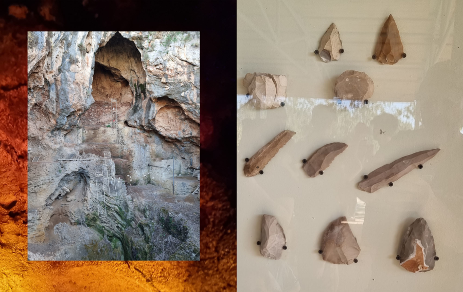
The Tabun Cave is a prehistoric site located in Israel, near Zichron Yaacov and Fureidis not far from Haifa District of Israel. . The cave is known for the discovery of Neanderthal remains, which were found there in the 1930s by archaeologist Dorothy Garrod. These remains, along with other artifacts and tools found in the cave, have provided important insights into the lives and culture of Neanderthals and have helped to shed light on the early history of human evolution.

The Tabun Cave is one of a number of prehistoric sites in the region, and it is believed to have been used by Neanderthals for a variety of purposes, including as a place to live and as a site for carrying out activities such as hunting and foraging for food. The cave contains several layers of sediment, which have allowed researchers to study the changes in Neanderthal culture and behavior over time. The Tabun Cave is a significant site for the study of human evolution and has contributed greatly to our understanding of the history of our species.

The route of the ancient man caves, including audio-visual vision

A circular geological route
The Ancient Man’s Trail – a tour route that climbs the stairs and goes up to the entrance of the Tabun cave named after the opening in its ceiling. The first excavations in this cave were conducted in 1927, led by researcher Dorothy Garrod. Today a delegation from the University of Haifa is excavating the cave, and the excavation is done in layers that are about 20 meters deep. The route continues to the camel cave, so called because its shape resembles a hump.

It is possible that an activity of raw material processing was carried out in the Camel Cave. In this cave there are exhibits that illustrate the nature of life in the various prehistoric periods. In the next cave on the route, the river cave (al-Wad), there is a spacious entrance hall, and at the end a narrow corridor that is about 70 meters long. In front of the front of the cave stretches a wide rock step. Most of the findings in the cave belong to the culture known as Aurignacian (40,000 to 20,000 years before our time). The cave was abandoned for several thousand years, and when man returned to the place, the center of gravity of life moved to the entrance hall and the rock step in front of the cave (the Natopian culture, 12,000-10,000 years before our time). In this cave, an audio-visual presentation illustrating the way of life of ancient man is shown, and at the entrance there is a reconstruction of a burial site.

The botanical trail – a circular route marked with blue trail markings. The path leads east along the length of Nahal Ma’rat and climbs through dense Mediterranean vegetation on the southern side of the stream to the top of the ridge, where it passes through a natural forest of Jerusalem pine. From there it continues west to an impressive view of the Carmel beach and the sea and descends back to the starting point.

The geological trail – a circular route that climbs to the top of the northern cliff of the reserve. The path is controlled by wooden posts engraved with arrows and station numbers. From the highest point on the route there is a spectacular view towards the Carmel beach plain.

The path to Merat HaGadi – a short path leads to the easternmost prehistoric cave in Nahal Merat. Skeletons of modern man (Homo sapiens), belonging to the Mousterian culture (around 90,000 years ago) were found in the cave. This finding indicates that it is possible that a population of modern man lived in Nahal Merot next to the population of Neanderthal man, which existed in the Tabon Cave.

The Baha'i gardens in Haifa

The Baha'i gardens in Haifa

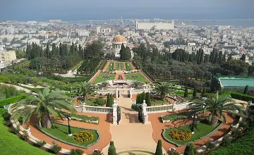
The Baha'i gardens in Haifa are made up of nineteen tiered gardens (terraces) starting at the top of Mount Carmel and ending at its foot. The central axis around which the gardens were designed points towards Acre, a city of great historical and religious significance for the Bahá'ís. In the heart of the gardens stands the temple of the Báb with its golden dome, the resting place of the prophet-forerunner of the Bahá'í religion. The different parts of the gardens offer a variety of views and sensations, but all are united by a common language of gravel paths, designed shrubs and flower beds, which are nurtured and cared for by a dedicated team of gardeners. From the gardens there is a spectacular panoramic view of the city, the Galilee mountains and the Mediterranean Sea. The Bahá'í Gardens are religious sites open to the general public free of charge. As is customary on sites of this type, visitors are asked to dress in modest clothing that covers the shoulders and reaches to the knees and without tears, to help keep the site clean and beautiful, and to behave in a manner that considers the sensitivities of others. Dress Code: Please wear clothes that cover the shoulders and reach to the knees and without tears. Due to the cobblestone paths and sidewalks that can be slippery, we recommend wearing comfortable shoes with good grip. In the summer months, we recommend wearing a hat and applying sunscreen. Photography is allowed, except inside the temples. Food and drinks Visitors are encouraged to bring bottles of water with them. Drinking other beverages, eating food, chewing gum, and smoking are prohibited in the gardens. Main entrance Sderot Zion 80 048313131

The Tabun Cave is a prehistoric site – A Neanderthal cave! The Tabun Cave is a prehistoric site – A Neanderthal cave!

Tel Arad National Park

Get to know Tel Arad National Park Canaanite water plant from the early bronze ages Remains of early bronze era fortifications A citadel from the iron age with a unique temple  Overnight parking -the Canaanite Khan: Flowering concentration of brown iris and loess soil vegetation.  At the beginning of Canaan's urbanization period, Canaanite Arad was already a planned city. It is surrounded by a wall and is divided into residential and public buildings. Arad was an urban center for the residents of the area. The richness of the findings found in the excavations shows a variety of economic branches such as husbandry, grazing, art and commerce. Arad was a well-developed place. Here are some of the main sites:  The water reservoir:  The houses in the city were built in such a way that the rainwater that trickled down the slope was collected in a reservoir surrounded by buildings on three sides. A 16 m deep well was dug in the center of the reservoir, probably in the early Israeli period. The east of the reservoir remains open, where the dam was built to stop the runoff.  The fortifications:  In addition to its 1,200 m long and 2.4 m thick walls, Arad the Canaanite was surrounded by a strong wall. Originally, the wall was five meters high. It was covered in bugs, had towers protruding from it, and followed the watershed of the hill. It is known today that there was only one gate in the wall, but it is possible that there were more.  The residences:  There was a uniform style of building houses in Arad known as the Aradi house. It was built with stone benches along the walls, and the floor was lower than the street level, so one or more steps were necessary to enter it. It is a transverse stone structure whose floor was lower than the street level. A wooden pole was placed in the center of each hall to support a flat roof on a stone base. On the side of the central hall there were sometimes a side room or two, which were probably used as a storeroom and a kitchen. Only the foundations of the walls survived from the Arad houses, and a small clay model of a house discovered in the excavations helps to complete the picture. The model is on display at the Israel Museum in Jerusalem.  The "palace": Its location between the western city gate and the water reservoir suggests it served as a governmental complex with many rooms, cells, and courtyards. Its center contains important finds, including a ritual stele.  The temples:  Two large temples, two small temples, and a single temple were found near the palace, surrounded by a stone fence. Similar temples were found in Ein Gedi (Chalcolithic period) and Megiddo (Early Bronze Age). Similar to Bet Aradi, the temples have wide rooms with courtyards. The temples are surrounded by stone tombstones, platforms for sacrificing animals, and ritual basins. There may be several gods worshiped by the multiplicity of temples.  Citadel Hill  As a link in the fortress system of Judah, the citadel on the site is a fortified structure (50x55 m). Arad was home to 6 citadels during the royal period, this one on top of the previous one. It was discovered that the citadel had a unique temple and a unique water plant. The Nature and Parks Authority restored and conserved the temple and prepared a path to the water plant for visitors.  The temple:  There were traces of a Jewish temple in the northwestern corner of the citadel, which operated during the same period as the temple in Jerusalem, from the 9th century to the end of the 8th century BC. In addition to being one of the few temples from the biblical period, Arad's temple was designed in accordance with the Tabernacle plan, and it had an inner courtyard, a hall, and a sanctuary - the Holy of Holies. A square altar in the courtyard is composed of dirt mixed with small stones, surrounded by field stones (unhewn stones). According to the biblical commandment, this altar does not contain stones that were hewn with metal tools. There are three steps to the Devir, which is located west of the courtyard. There are two altars of incense at the entrance to Devir, and a tombstone is inside. An ostrakon (pottery with inscriptions) was found near the temple that listed the names of priestly families mentioned in the Scriptures (Mermot, Ezra 8:33, and Pashhur, Jeremiah 6:1). It appears that the temple was abandoned in the 8th century BC. As the citadel continued to serve its purpose, it was completely covered in dirt. A possible explanation is the religious reform of King Hezekiah and Yeshua, who centralized worship in Jerusalem by abolishing worship in the cities of the field. At the same time, Tel Bar's altar was also dismantled seven times.  The water plant:  Near the temple are three carved and plastered spaces accessible by a channel cut into the rock. Part of the staircase leading to them has been preserved. The spaces are impressive. They are accessible through a channel cut into the western wall. Near Beit Elyashiv's southern wall, a cache of ostracos, most of which are written in ancient Hebrew script, has been found. The house contained 17 ostracones addressed to a man named Eliashiv, probably the commander of Tel Arad's citadel. Three seals bearing his name were also found there.  Overnight parking - The Canaanite Khan : There are six accommodation pavilions, a private tent area, and a caravan area on the parking lot for the Hellenes, as well as a closed building with mattresses and heating. Among the amenities in the parking lot are drinking water, toilets, hot showers, a cooking area, outdoor lighting, and electricity outlets.

Tabor Stream - A Natural Gem in the Heart of the Lower Galilee

Tabor Stream - A Natural Gem in the Heart of the Lower Galilee

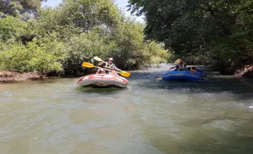
Tabor Stream, one of the most beautiful nature sites in the Lower Galilee, offers a refreshing hiking experience for the whole family. The year-round flowing water and stunning spring blossoms make it an ideal destination for nature lovers. Information and Preparations for the Trail - Moderate difficulty level, with a challenging ascent at the end. Suitable for experienced children or parents with carriers. - Bring hiking shoes, water (3 liters per person), and start the trail no later than 2:00 PM. - No trash cans along the trail - please keep it clean and take your garbage with you. - No dogs allowed (except guide dogs). - SOS WIFI system available for emergency assistance. Two Trail Options 1. Long circular route (approx. 8 km, 3-4 hours) 2. Shorter scenic circular route (approx. 3 km) Getting There - From Highway 65, turn east at Gazit Junction towards Kibbutz Gazit. Park near the start of the red trail. Description of the Long Trail - Head east on the red trail, descend to the stream bed and continue north on the blue trail. - Along the way: diverse vegetation, a basalt canyon with waterfalls and pools, and scenic lookouts. You can dip your feet in the water (bathing not recommended). - Pass by the ancient Tel Rechesh and continue with a steep ascent to the Oren Lifshitz lookout. - Continue on the blue trail, then the black trail, and back to the red trail until the starting point. Short Trail - Start eastward on the red trail, turn left onto the green trail to the lookout. - Continue on the blue trail around the Kibbutz Gazit orchard, without descending to the stream. - Return via the black trail and back to the red trail until the parking area. Important Notes - Check the weather and act responsibly. After rain - high boots are recommended. - The trails are recommendations only. Accommodation and Further Trips The nearby Old City of Nazareth offers a tour of picturesque alleys, a visit to the Basilica of the Annunciation, and excellent restaurants. Consider staying overnight and continuing your trip in the north the next day.

Israel's favorite Tour - More options
Please wait...
  • Please wait while the system searches for you the perfect vacation at the best prices.

Search for

Why Inisrael.com?

  • Book direct - We connect you to the hotels.
  • The best hotel deals in Israel.
  • You pay at the hotel - upon arrival.
  • Credit card for room guarantee, no upfront payment.
  • The first israel booking site since 1996.