Hotels Locations

more locations
hide locations
inisrael.com travel guide

Search for

Enjoy Israel

HE
The Ashalim power station
inisrael.com travel guide

Israel Hotels

Enjoy Israel

The Ashalim power station

The Ashalim power station

The Negev travel guide

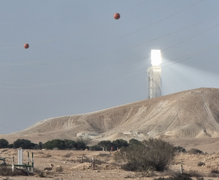
The Ashalim power station is a solar power station in the Negev desert near the kibbutz of Ashalim, south of the district city of Be’er Sheva in Israel. It consists of three plots with three different technologies the station combines 3 kinds of energy: solar thermal energy, photovoltaic energy, and natural gas.

In the 1950’s, David Ben-Gurion spoke about his vision for “exploiting the abundant solar energy in our country and especially in the Negev”. Six decades later, drivers to Eilat are witnessing a remarkable shiny site, a thermo-solar power station in Ashlim in the Negev. The uniqueness of the station, whose construction began in 2015, is the production of electricity from energy produced from the radiation of the sun’s rays using half a million mirrors during the day. The mirrors are installed on steel constructions which are fixed to the ground, heating thermal oil inside insulated tubes to a temperature of 400 degrees Celsius. A system of heat exchangers heats water which creates steam that runs a huge turbine. A generator is connected to the turbine that supplies electricity.
Another effect of this station is the ability to store solar energy during the day, which is released during the night and produces additional electricity for about 5 hours and all this as mentioned without direct sunlight. The storage of the additional energy is made possible by means of two large steel tanks (made of steel with a lower wall thickness of about 63 mm and weighing 1,070 tons each), which store inside a special chemical salt that heats up during the day and heats the oil during the night.
The project covers an area of ​​about 400 Hectares, and is expected to supply electricity to about 60,000 households. This amount of electricity is equivalent to 1% of the total national consumption.
The supply of the station is 121 MWh and the annual output is about 450 GWh.
15% of the energy produced at the station is utilized from natural gas that will be transported through pipes laid by the Negev Gas company to the entrance of the station.

Mitzpe Ramon - Ramon Lookout

Mitzpe Ramon - Ramon Lookout

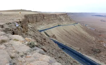
Mitzpe Ramon - Ramon Lookout is a town in the Negev desert of southern Israel. It is situated on the northern ridge at an elevation of 2,400 feet (800m.) overlooking an enormous erosion cirque known as the Ramon Crater. This crater, or “Machtesh”, as it is called in Hebrew (a term also used by geologists around the world) is 28 miles long and five miles wide. It is a formation unique to Israel and the Sinai. Ramon Crater Ramon Crater is the largest one one of the three Negev craters. It contains geological formations unparalleled elsewhere in the world. Together with magnificent panorama, it presents a fascinating story of geomorphologic evolution. The Ramon Nature Reserve encompassing the crater and the Negev mountains surrounding it is the largest nature reserve in Israel. Mitzpe Ramon was originally founded in 1951 as a camp for the workers building the road to Eilat. The town's first permanent residents, immigrants from North Africa and Romania, settled there in the 1960s, and it became the southernmost of the Negev's development towns. The development of Mitzpe Ramon was adversely affected by the opening of Route 90 in the late 1960s. After the inauguration of this highway, traffic to and from Eilat bypassed Mitzpe Ramon almost entirely. However, growing interest in ecotourism, jeep trekking and hiking, and the upgrading of Route 40, which is considered a more scenic route to Eilat, have improved matters since the mid-1990s. There is a visitors center overlooking the Ramon Crater and the fit can walk down into the crater for a 4 to 5 hour trek without any shade. There is a Lama and Alpaca farm and other attractions.

The Ashalim power station The Ashalim power station

Tel Arad National Park

Get to know Tel Arad National Park Canaanite water plant from the early bronze ages Remains of early bronze era fortifications A citadel from the iron age with a unique temple  Overnight parking -the Canaanite Khan: Flowering concentration of brown iris and loess soil vegetation.  At the beginning of Canaan's urbanization period, Canaanite Arad was already a planned city. It is surrounded by a wall and is divided into residential and public buildings. Arad was an urban center for the residents of the area. The richness of the findings found in the excavations shows a variety of economic branches such as husbandry, grazing, art and commerce. Arad was a well-developed place. Here are some of the main sites:  The water reservoir:  The houses in the city were built in such a way that the rainwater that trickled down the slope was collected in a reservoir surrounded by buildings on three sides. A 16 m deep well was dug in the center of the reservoir, probably in the early Israeli period. The east of the reservoir remains open, where the dam was built to stop the runoff.  The fortifications:  In addition to its 1,200 m long and 2.4 m thick walls, Arad the Canaanite was surrounded by a strong wall. Originally, the wall was five meters high. It was covered in bugs, had towers protruding from it, and followed the watershed of the hill. It is known today that there was only one gate in the wall, but it is possible that there were more.  The residences:  There was a uniform style of building houses in Arad known as the Aradi house. It was built with stone benches along the walls, and the floor was lower than the street level, so one or more steps were necessary to enter it. It is a transverse stone structure whose floor was lower than the street level. A wooden pole was placed in the center of each hall to support a flat roof on a stone base. On the side of the central hall there were sometimes a side room or two, which were probably used as a storeroom and a kitchen. Only the foundations of the walls survived from the Arad houses, and a small clay model of a house discovered in the excavations helps to complete the picture. The model is on display at the Israel Museum in Jerusalem.  The "palace": Its location between the western city gate and the water reservoir suggests it served as a governmental complex with many rooms, cells, and courtyards. Its center contains important finds, including a ritual stele.  The temples:  Two large temples, two small temples, and a single temple were found near the palace, surrounded by a stone fence. Similar temples were found in Ein Gedi (Chalcolithic period) and Megiddo (Early Bronze Age). Similar to Bet Aradi, the temples have wide rooms with courtyards. The temples are surrounded by stone tombstones, platforms for sacrificing animals, and ritual basins. There may be several gods worshiped by the multiplicity of temples.  Citadel Hill  As a link in the fortress system of Judah, the citadel on the site is a fortified structure (50x55 m). Arad was home to 6 citadels during the royal period, this one on top of the previous one. It was discovered that the citadel had a unique temple and a unique water plant. The Nature and Parks Authority restored and conserved the temple and prepared a path to the water plant for visitors.  The temple:  There were traces of a Jewish temple in the northwestern corner of the citadel, which operated during the same period as the temple in Jerusalem, from the 9th century to the end of the 8th century BC. In addition to being one of the few temples from the biblical period, Arad's temple was designed in accordance with the Tabernacle plan, and it had an inner courtyard, a hall, and a sanctuary - the Holy of Holies. A square altar in the courtyard is composed of dirt mixed with small stones, surrounded by field stones (unhewn stones). According to the biblical commandment, this altar does not contain stones that were hewn with metal tools. There are three steps to the Devir, which is located west of the courtyard. There are two altars of incense at the entrance to Devir, and a tombstone is inside. An ostrakon (pottery with inscriptions) was found near the temple that listed the names of priestly families mentioned in the Scriptures (Mermot, Ezra 8:33, and Pashhur, Jeremiah 6:1). It appears that the temple was abandoned in the 8th century BC. As the citadel continued to serve its purpose, it was completely covered in dirt. A possible explanation is the religious reform of King Hezekiah and Yeshua, who centralized worship in Jerusalem by abolishing worship in the cities of the field. At the same time, Tel Bar's altar was also dismantled seven times.  The water plant:  Near the temple are three carved and plastered spaces accessible by a channel cut into the rock. Part of the staircase leading to them has been preserved. The spaces are impressive. They are accessible through a channel cut into the western wall. Near Beit Elyashiv's southern wall, a cache of ostracos, most of which are written in ancient Hebrew script, has been found. The house contained 17 ostracones addressed to a man named Eliashiv, probably the commander of Tel Arad's citadel. Three seals bearing his name were also found there.  Overnight parking - The Canaanite Khan : There are six accommodation pavilions, a private tent area, and a caravan area on the parking lot for the Hellenes, as well as a closed building with mattresses and heating. Among the amenities in the parking lot are drinking water, toilets, hot showers, a cooking area, outdoor lighting, and electricity outlets.

Be'er-Sheva Lake - one of the largest artificial lakes in the world

Be'er-Sheva Lake - one of the largest artificial lakes in the world

"Lake" in Be'er Sheva is a unique project establishing an artificial lake that covers about 23 acres and is entirely filled with effluent water. About 167 acres of the park are dedicated to lawns, wooded areas, picnic areas, hiking and biking trails, and leisure and recreation areas. The lake is one of the largest artificial lakes in the world, and it is considered the second largest lake in Israel, after the Sea of Galilee. The lake has become a major tourist attraction that includes restaurants, cafes, and other recreational facilities. The project was developed in partnership with JNF USA, KKL, and the government of Israel, with a total cost of NIS 450 million. The city of Beersheba has a rich cultural and historical background, and the municipality is working on promoting tourism to the city by integrating hoteliers and restaurateurs. The Beer Sheva River Park and the lake are included in the tourism map of the Negev, and will offer visitors a range of experiential ventures for the whole family.

Israel's favorite The Negev - More options
Please wait...
  • Please wait while the system searches for you the perfect vacation at the best prices.

Search for

Why Inisrael.com?

  • Book direct - We connect you to the hotels.
  • The best hotel deals in Israel.
  • You pay at the hotel - upon arrival.
  • Credit card for room guarantee, no upfront payment.
  • The first israel booking site since 1996.