Nahal Taninim
Sharon Area travel guideNahal Taninim is a solid stream that begins in Ramot Menashe between Dalia and Ein Hashofet. The stream flows southwest to the Mediterranean Sea and empties into the sea south of Kibbutz Maagan Michael.
A magical nature reserve located 40 minutes from the center of the country where you will find everything you need for a delightful walk – an easy route on wooden bridges over the waters of a peaceful stream, glorious history of Caesarea water plant and even an impressive restored dam, animals, birds and flowers (in season), and for dessert – A story about the crocodiles that lived in the creek and gave it its name!
Near Moshav Amikam, Mekorot built a dam on the Nahal Taninim canal as part of the Nahal Menashe plant. During the winter days when the flow in the Gaza River, the river water (as well as the Ada, Barkan and Mishmarot streams) is diverted to a canal that carries the water to a sedimentation reservoir to enrich the groundwater, which is located in the Caesarea sands.
In the reserve flows Nahal Taninim stream, named after the crocodiles that lived in the waters of swamps as well as until the beginning of the twentieth century. Today there are no more crocodiles here, but you will still find plenty of animals: waterfowl, fish and turtles.
Nahal Taninim is the only clean river that flows into the Mediterranean Sea and its waters have never been polluted with sewage. When you walk here you will see the remains of a very impressive dam, built in the late Roman period and early Byzantine period. The dam created a large lake at the site, from which water was discharged to Caesarea through the low aqueduct. Several flour mills also operated at the site, the remains of which were completely uncovered by chance after a few winters in the 1990s flooded the area with rainwater that caused severe damage to agricultural land. To prevent the flooding, works were carried out in the area during which the huge dam, which was covered with alluvium, was discovered here.
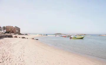
Estuary area
The place used to be a large dam that created a lake for the operation of flour mills and a source for the water aqueduct of Caesarea. There was also a city from the Persian period called Crocodilopolis. South of the lake are the remains of the beginning of the ancient aqueduct from the Roman period that was used to transport water to Caesarea. The lack of maintenance of the dam site resulted in the formation of an egg known as the Kabara Egg. Today, there is a nature reserve in the area of the estuary, which is the Nahal Hataninim nature reserve and in its territory is the Birkat Tamasach, a remnant of the Kabara swamp. South of Nahal Hataninim, the village of Jisr a-Zarqa was established. The name in Arabic means the bridge over the Blue River. The village is inhabited by Bedouins of Bedouin descent from the Arab al-Jawarna tribes of North Africa, miners from Syria who raised cattle in the Hula Valley and brought by the Ottomans and Abyssinians from Sudan brought by the British. The same tribes were brought in because they thought they were resistant to the mosquito fever and so would be able to cultivate the land despite the swamps. In the river and its surroundings a diverse living and vegetative world: water turtles and catfish in the water, lakes and waterfowl and aquatic vegetation such as reed, great reed and holy raspberry.


