Hotels Locations

more locations
hide locations
inisrael.com travel guide

Search for

Enjoy Israel

HE
inisrael.com travel guide

Israel Hotels

Enjoy Israel

Golan – Fast Facts

Golan Heights travel guide

Area………………………………….1,158 sq km
Border length with Syria……..80 km
Highest peak……………………..2,224 meter above sea level
Villages……………………………..36
Jewish……………………………….32
Druze villages…………………….4
Main town…………………………..Katzrin. (the only town)
Jewish population ……………..16,500
Druze population………………..17,000
Nature reserve……………………246 sq km
Cultivated area…………………..80 sq km
Grazing lands……………………..460 sq km
Guest rooms………………………1,100
Cattle…………………………………19,950 head
Sheep………………………………..5,000

https://www.inisrael.com/golan/fastfacts.htm

Nimrod Fortress: A Historic Castle with Stunning Views in the Golan Heights

Nimrod Fortress: A Historic Castle with Stunning Views in the Golan Heights

Nimrod Fortress, also known as Nimrod Castle, is a castle built by the Ayyubids and expanded by the Mamluks to guard a major access route to Damascus against armies from the west. It is located on the southern slopes of Mount Hermon, overlooking the Golan Heights. The fortress was first built in the Hellenistic or Byzantine period and was rebuilt around 1228 by Al-Aziz Uthman. It was further expanded by Sultan Baibars and given to his second-in-command, Bilik. After the Muslim conquest of Acre, the fortress lost its strategic value and fell into disrepair. The Ottoman Turks later used it as a luxury prison for Ottoman nobles. The fortress is currently managed by the Israel Nature and Parks Authority and is open to the public. Visitors can explore the excavated and restored portions of the fortress, including secret corridors, loopholes, and the remains of a keep surrounded by large rectangular towers. One day tour idea for the region could be visiting Nimrod Fortress and exploring the surrounding area. The tour could start with a visit to the fortress, where visitors can learn about its history and architecture and enjoy panoramic views of the Golan Heights. After exploring the fortress, the tour could continue to nearby Banias Nature Reserve, which offers hiking trails, waterfalls, and natural pools. Visitors can hike along the river, explore the ancient ruins of Banias, and enjoy a picnic lunch in the beautiful surroundings. The tour could also include a visit to the nearby Druze village of Majdal Shams, where visitors can learn about Druze culture and enjoy traditional Druze cuisine. Overall, this day tour offers a combination of history, nature, and culture, making it a great way to experience the region.

Discover the Unique Beauty of El Al Stream: A Comprehensive Guide to Hiking in Golan's Scenic Terrain

Discover the Unique Beauty of El Al Stream: A Comprehensive Guide to Hiking in Golan's Scenic Terrain

Unraveling the Etymology of El Al Creek. The captivating El Al stream in the southern Golan winds through the narrow Wadi Dufila canyon, colloquially known as the "Haunted Bush Creek." This picturesque stream spans 20 kilometers, the trek through its alluring central section offering a sight to behold. Adorned with two grand waterfalls, each with their own unique charm and inviting water pools at their bases, Nahal El Al holds the title as the southernmost perennial stream in the Golan region. The "Black Waterfall," a beautiful basalt spectacle, cascades from an impressive height of about 8 meters. In stark contrast, the "White Waterfall" is a limestone structure that flows from an approximate elevation of 20 meters. This year-round stream and its idyllic natural pools are sightseers' delights. The pathway through this wondrous terrain can commence at Moshav Eliad and conclude at the parking lot adjacent to the waterfalls, near Moshav Avni Itan. Alternatively, the journey can be experienced in reverse order. Strollers can enjoy a route parallel to the stream, teeming with life throughout the year. Exploring the Route 
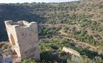
Embarking on this journey, you'll descend into the stream as directed by signs, following the red-marked path through an olive vineyard, between hedgerows, and into the gorge that descends from the El Al village ruins. After crossing the gorge, you'll encounter a picturesque viewpoint. It's here where the stream forms a "knee," altering its flow direction from southwest to northwest. Continuing along the red path near the olive grove, you'll descend a white chalk rock slope towards the white waterfall after about 500 meters. Once you near the waterfall, a staircase fashioned from railway sleepers diverts you to the pool at the base of the waterfall. Progressing further to the Black Waterfall, you'll resume your journey along the red-marked path, situated at the top of the white waterfall, and cross the stream. The path meanders alongside the stream, within a thicket of haunted bushes, and ascends slightly after about 500 meters. The path stays a few meters above the gorge, where the white rock gradually transitions to black basalt rocks. As you continue your trek, ensure you follow the "transparent" marking (two white stripes with no color in the middle) towards the black waterfall. This waterfall cascades onto basalt rocks, forming a small pool surrounded by dolav trees that cast a cooling shade. Finally, return to the red trail, cross the stream's shallow bed, and ascend a steep climb back to the parking lot in Moshav Avni Eitan. Geological Wonder The coexistence of a white waterfall and a black waterfall is a truly unique and fascinating spectacle. The Golan's basalt kilhos blanket thick layers of white marine sedimentary rocks. The water first creates a waterfall as it travels beneath the black basalt rock, then continues to cut deeper until it reaches the sedimentary rocks beneath the basalt, forming a second waterfall. Note: Swimming in the creek pools is undertaken at the swimmers' own risk. Given the route's length, it's recommended to arrange transport at the endpoint. You can return to the starting point via a 3.5 km boardwalk connecting Eliad and Avni Eitan. Travel and Safety Guidelines: In the Golan, adherence to the marked path is critical; crossing fences or straying off the path can lead to dangerous minefields. Never venture into areas designated for army shooting training! Always pass through cattle fences at designated points, opening and closing gates as needed. Avoid climbing or cutting fences, and exercise caution when crossing or walking on roads. Overnight stays are only permitted at designated sites, and fires should never be left unattended or lit under trees. Toilet paper should not be burned, and all trash should be taken with you to preserve the natural beauty of the area.

The Golan Geography

The Golan Geography

The Golan has two geographically distinct sections-the Hermon Range in the north and the Golan plateau in the south. The former is one of the highest mountain ranges in Israel; In the entire region, in fact. Actually, only seven percent of the range lies in Israel: the rest is divided equally between Syria and Lebanon. The total length of the range is 80 kilometers, and Its width varies between 17 and 23 kilometers. The summit of the Hermon Range, Mount Hermon in Syria, is 2,814 meters above sea level The range's second highest peak, Mitzpeh Shlagim in Israel, is 2,224 meters above sea level. The Golan plateau begins Immediately to the south of the Hermon Range. It is a startlingly large, sixty- kilometer-long, basalt-covered tableland, sliced off by deep canyons at its edges. The plateau slopes gently from north to south, descending from 1,200 meters above sea level on its northern edge to 300 meters above sea level at its southern rim. The area to the west of the Golan, however, encompassing the Hula Valley and the Sea of Galilee (the Kinneret), is 200 meters below sea level, and the dramatic disparity creates some majestic scenery along the sharp escarpment that marks the Golan's western border. On that side of the Golan, water courses down ravines and canyons to basalt waterfalls that hurl the melted snows of winter into a series of deep secluded pools. The basalt on the Golan comes from a series of now extinct volcanoes whose thumb-like contours and craters dot the Golan. serving as good scenic lookouts alongthe flat plateau. Volcanic activity on the Golan has also resulted in geological formations created by the lava that once flowed out of the volcanoes, as well as a myriad of paleornagnetic phenomena. https://www.inisrael.com/golan/geography.htm

Israel's favorite Golan Heights - More options
Please wait...
  • Please wait while the system searches for you the perfect vacation at the best prices.

Search for

Why Inisrael.com?

  • Book direct - We connect you to the hotels.
  • The best hotel deals in Israel.
  • You pay at the hotel - upon arrival.
  • Credit card for room guarantee, no upfront payment.
  • The first israel booking site since 1996.