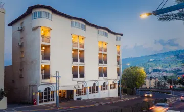
Are you looking for a stylish and luxurious hotel that transports you to another era while providing modern comforts? Look no further than Hotel Jacob in Tiberias, the leading traveler hotel in the north of Israel. Inspired by classical Israel, this hotel seamlessly blends European elegance with Ottoman style, creating a fashionable and captivating ambiance.
Situated in the heart of Tiberias, Hotel Jacob offers a convenient location near popular tourist attractions, nature reserves, historical sites, and sacred places revered by multiple religions. Whether you're seeking a cultural experience or planning to explore the beauty of Galilee and the North, this hotel serves as the perfect starting point for your adventures.
Accommodation at Hotel Jacob is designed to cater to the diverse needs of travelers. The standard rooms, ranging from 18 to 22 square meters, provide a comfortable retreat. These air-conditioned rooms are equipped with a 32" TV, a hot drinks corner, a desk, a safe, a mini-bar fridge, and a bathroom complete with a hairdryer and bathroom accessories. It's the ideal choice for solo travelers or couples seeking a cozy and well-appointed space.
For families, the hotel offers spacious family rooms measuring 22 to 27 square meters. These rooms comfortably accommodate a couple with two children. Featuring air conditioning, a double bed, and a sofa that opens into a bed, these rooms ensure a relaxing and enjoyable stay for the whole family.
If you're seeking a touch of luxury, the suite at Hotel Jacob is an excellent choice. With 32 square meters of space, it provides ample room to unwind and indulge. The suite boasts a large private balcony offering stunning views of Tiberias and the Sea of Galilee, allowing you to savor the breathtaking beauty of the region.
Upon entering the hotel lobby, you'll immediately be captivated by its Middle Eastern charm. Designed to embody the multifaceted nature of Israel, the lobby seamlessly blends European sophistication with Ottoman character, creating a unique and inviting atmosphere. Luxurious seating areas invite guests to relax, while the bar offers refreshing drinks and light snacks, perfect for unwinding after a day of exploration.
Hotel Jacob is not only a fantastic destination for leisure travelers but also an ideal venue for meetings and events. The hotel provides modern and well-equipped spaces that can accommodate various needs. Equipped with the latest technology, including projectors, large TV screens with HDMI connection, and high-speed internet, these spaces ensure the success of your meetings or conferences. The entrance hall features a unique and large wooden table suitable for 14 participants, creating an impressive setting for important discussions. Additionally, the fourth-floor meeting room, designed like a theater, can host up to 50 participants, while the event hall is perfect for special events, conferences, and multi-participant meetings.
When it comes to dining, Hotel Jacob leaves no stone unturned. Start your day with a rich Israeli-style buffet served in the impressive dining room. Indulge in a variety of salads, cheese trays, eggs, fresh bread, juices, and more, ensuring a satisfying start to your day. In the evening, you can choose from a delectable selection of fine meat and vegetarian dishes that cater to every palate. After your meal, head to the bar and enjoy a drink of your choice to wind down and relax.
Hotel Jacob in Tiberias truly stands out as a leading traveler hotel in the north. Its fusion of historical charm and modern luxury creates a memorable and immersive experience for guests. Whether you're visiting for leisure or business, the hotel's convenient location, comfortable accommodations, state-of-the-art facilities, and exceptional dining options make it an excellent choice. Immerse yourself in the captivating ambiance and warm hospitality of Hotel Jacob, and make your stay


