Discover NOW hotel Eilat: Luxury Redefined in the Heart of Mediterranean
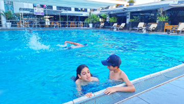
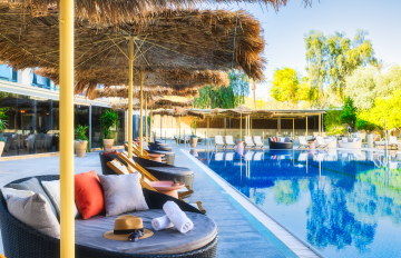
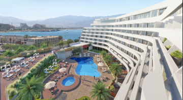
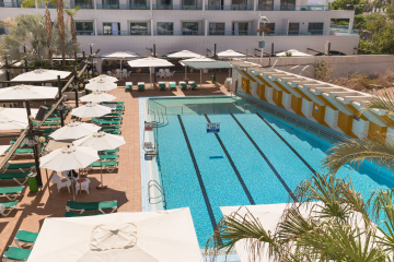
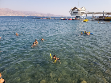
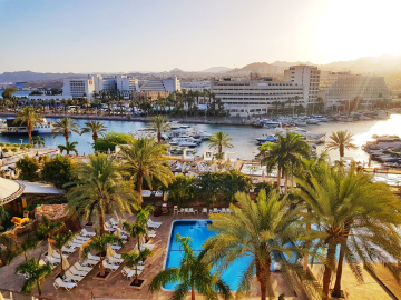
In the heart of the sun-kissed city of Eilat, a boutique gem awaits travelers. A place where everything happens in the present, where the present moment is celebrated and savored. Introducing the NOW Eilat, an innovative boutique hotel, steeped in Mediterranean charm and offering a whole new paradigm of luxury and leisure. Perched only 200 meters from the beach, this prestigious hotel caters exclusively to adults over 18, making it an idyllic sanctuary for couples and groups seeking a luxurious vacation in a laid-back atmosphere. NOW Eilat offers an exceptional blend of traditional charm and contemporary style. It houses 19 meticulously curated boutique rooms, each with its unique specifications and design. These rooms are spread over two floors, with 14 double rooms and 5 rooms capable of hosting up to three guests. A number of special accommodations take your experience to a whole new level. Rooms with private swimming pools that are heated in winter, garden rooms with Jacuzzis, and pampering suites await you. For those with mobility impairments, an accessible room equipped with a private pool ensures a comfortable and enjoyable stay. Two pools serve as the hotel's vibrant hubs, one centrally located on the restaurant floor and a rooftop pool exclusively for guests and VIP events. Both pools adapt to the weather conditions, with heating in the winter, creating a year-round oasis. At the heart of the hotel is MOOD, a chef-driven restaurant that promises to take you on a gastronomic journey. With a menu that evolves throughout the day, MOOD offers a rich array of dishes for hotel guests and outside visitors alike, accompanied by a robust bar serving hot and cold alcoholic beverages. NOW Eilat’s level of service takes the concept of personalization to the extreme. The hotel's "Jokers" are on hand round the clock to cater to all your needs. Furthermore, dedicated spa treatments can be ordered directly to your room, ensuring a truly indulgent experience. Let’s delve into the various room types: Balcony Rooms (Rooms 201, 202, 203, 204): These standard rooms located on the 2nd floor are embellished with an outdoor balcony overlooking the street. Designed for a perfect couple's vacation, they offer the luxury of tranquility, albeit with a higher noise scale on brunch weekends. Pool & Restaurant View Rooms (Rooms 206, 207, 208): These are also on the 2nd floor, offering a balcony with views of the pool and restaurant. Do note, there's no direct pool access from the balcony, and these rooms also see increased noise during weekend brunches. Garden Rooms with Jacuzzi (Rooms 101, 102, 103, 104, 105): These rooms on the ground floor offer the ultimate in relaxation. A large balcony with sunbeds, a beach shower, and a rustic seating area makes these rooms an inviting retreat, particularly quieter on brunch weekends. Junior Suite (Room 109): This spacious suite on the ground floor features a garden balcony complete with sunbeds, a beach shower, and a rustic seating area. This suite is capable of hosting up to three guests, providing a tranquil getaway, especially on the quieter brunch weekends. Royal Suite (Room 205): This luxurious suite offers direct access to the heated pool and the chef's restaurant from a private corner balcony. With views over the beautiful lagoon of Eilat, this suite accommodates up to three guests for an opulent experience, although it is noisier on brunch weekends. All rooms come with a noise scale rating to ensure guests' preferences are well catered for. NOW Eilat offers you a blend of tranquility, luxury, and a dash of the Mediterranean lifestyle. Come, make the present moment unforgettable at NOW Eilat. Your exclusive vacation awaits you.